
Thank you for supporting this site ❤️
Make a donation
Make a donation
Selão topographic map
Click on the map to display elevation.
Thank you for supporting this site ❤️
Make a donation
Make a donation
About this map
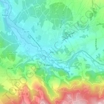
Name: Selão topographic map, elevation, terrain.
Location: Selão, Colares, Sintra, Lisboa, 2705-216, Portugal (38.78417 -9.46454 38.82417 -9.42454)
Average elevation: 109 m
Minimum elevation: 1 m
Maximum elevation: 357 m
Thank you for supporting this site ❤️
Make a donation
Make a donation
Other topographic maps
Click on a map to view its topography, its elevation and its terrain.