
Thank you for supporting this site ❤️
Make a donation
Make a donation
Reguenga topographic map
Click on the map to display elevation.
Thank you for supporting this site ❤️
Make a donation
Make a donation
About this map
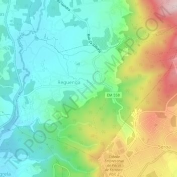
Name: Reguenga topographic map, elevation, terrain.
Location: Reguenga, Santo Tirso, Porto, Portugal (41.26215 -8.47033 41.28689 -8.42927)
Average elevation: 213 m
Minimum elevation: 118 m
Maximum elevation: 423 m
Thank you for supporting this site ❤️
Make a donation
Make a donation
Other topographic maps
Click on a map to view its topography, its elevation and its terrain.