
Chhatru topographic map
Interactive map
Click on the map to display elevation.
About this map
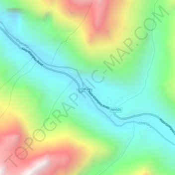
Name: Chhatru topographic map, elevation, terrain.
Location: Chhatru, Lahul and Spiti, Himachal Pradesh, India (32.29974 77.34568 32.33974 77.38568)
Average elevation: 3,809 m
Minimum elevation: 3,276 m
Maximum elevation: 4,838 m