
Barakani topographic map
Interactive map
Click on the map to display elevation.
About this map
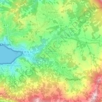
Name: Barakani topographic map, elevation, terrain.
Location: Barakani, Ouangani, Mayotte, 97670, France (-12.85913 45.11113 -12.81913 45.15113)
Average elevation: 129 m
Minimum elevation: 0 m
Maximum elevation: 307 m
Other topographic maps
Click on a map to view its topography, its elevation and its terrain.