
Bel-Air topographic map
Interactive map
Click on the map to display elevation.
About this map
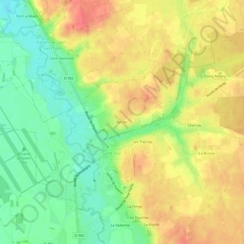
Name: Bel-Air topographic map, elevation, terrain.
Average elevation: 255 m
Minimum elevation: 227 m
Maximum elevation: 279 m
Other topographic maps
Click on a map to view its topography, its elevation and its terrain.
Bois Battu
France > Bourgogne-Franche-Comté > Saône-et-Loire > Saint-Yan
Bois Battu, Saint-Yan, Charolles, Saône-et-Loire, Bourgogne-Franche-Comté, France métropolitaine, 71600, France
Average elevation: 272 m
Les Trèches
France > Bourgogne-Franche-Comté > Saône-et-Loire > Saint-Yan > Les Trèches
Les Trèches, Saint-Yan, Charolles, Saône-et-Loire, Bourgogne-Franche-Comté, France métropolitaine, 71600, France
Average elevation: 257 m