
Thank you for supporting this site ❤️
Make a donation
Make a donation
Eastern Region topographic map
Click on the map to display elevation.
Thank you for supporting this site ❤️
Make a donation
Make a donation
About this map
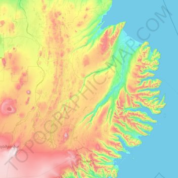
Name: Eastern Region topographic map, elevation, terrain.
Location: Eastern Region, Iceland (64.42220 -16.79710 65.96595 -13.49481)
Average elevation: 463 m
Minimum elevation: -2 m
Maximum elevation: 1,858 m
Thank you for supporting this site ❤️
Make a donation
Make a donation
Other topographic maps
Click on a map to view its topography, its elevation and its terrain.