
Singen topographic map
Interactive map
Click on the map to display elevation.
About this map
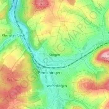
Name: Singen topographic map, elevation, terrain.
Average elevation: 201 m
Minimum elevation: 139 m
Maximum elevation: 287 m
Other topographic maps
Click on a map to view its topography, its elevation and its terrain.
Wilferdingen
Deutschland > Baden-Württemberg > Enzkreis > Remchingen
Wilferdingen, Remchingen, Enzkreis, Baden-Württemberg, 75196, Deutschland
Average elevation: 205 m