
Cotahuasi Subbasin Landscape Reserve topographic map
Interactive map
Click on the map to display elevation.
About this map
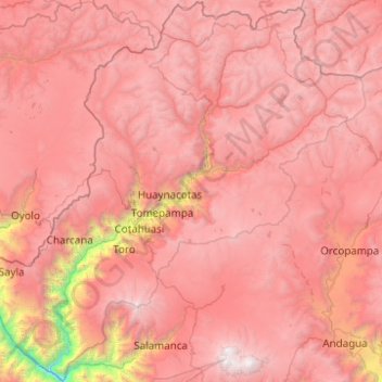
Name: Cotahuasi Subbasin Landscape Reserve topographic map, elevation, terrain.
Location: Cotahuasi Subbasin Landscape Reserve, Arequipa, Peru (-15.59243 -73.29382 -14.64460 -72.30300)
Average elevation: 4,390 m
Minimum elevation: 963 m
Maximum elevation: 6,381 m