
Au Leraye topographic map
Interactive map
Click on the map to display elevation.
About this map
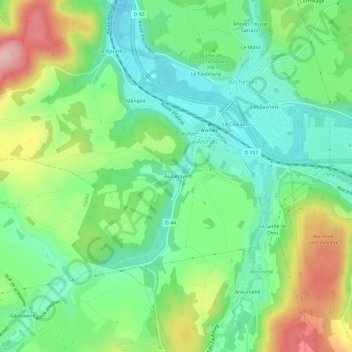
Name: Au Leraye topographic map, elevation, terrain.
Average elevation: 395 m
Minimum elevation: 333 m
Maximum elevation: 509 m
Other topographic maps
Click on a map to view its topography, its elevation and its terrain.
La Garde de Dieu
France > Grand Est > Vosges > Arches > La Garde de Dieu
La Garde de Dieu, Arches, Épinal, Vosges, Grand Est, France métropolitaine, 88380, France
Average elevation: 401 m