
Thank you for supporting this site ❤️
Make a donation
Make a donation
Harinsart topographic map
Click on the map to display elevation.
Thank you for supporting this site ❤️
Make a donation
Make a donation
About this map
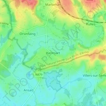
Name: Harinsart topographic map, elevation, terrain.
Location: Harinsart, Habay, Virton, Luxembourg, Wallonie, 6724, Belgique (49.68724 5.51616 49.72724 5.55616)
Average elevation: 344 m
Minimum elevation: 323 m
Maximum elevation: 389 m
Thank you for supporting this site ❤️
Make a donation
Make a donation