
Thank you for supporting this site ❤️
Make a donation
Make a donation
Mutscheid topographic map
Click on the map to display elevation.
Thank you for supporting this site ❤️
Make a donation
Make a donation
Mutscheid
Das Erscheinungsbild der Landschaft ist typisch für die Eifel, mit sanften Hügeln und kleinen Tälern. Sie fällt von einer Höhe von über 510 m ü. NHN an den Hängen des Michelsberges im Nordwesten ab auf unter 300 m im Südosten. Die höchste Erhebung mit 517 m ist die Lausnück in Soller. Bei der Vegetation wechseln sich zusammenhängende Baumbestände mit offenem Wiesenland ab. Ackerbau ist nur noch selten anzutreffen.
Thank you for supporting this site ❤️
Make a donation
Make a donation
About this map
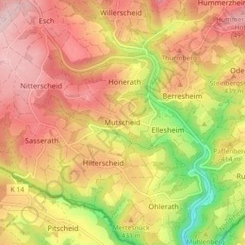
Name: Mutscheid topographic map, elevation, terrain.
Average elevation: 416 m
Minimum elevation: 276 m
Maximum elevation: 512 m
Thank you for supporting this site ❤️
Make a donation
Make a donation