
פרדס חנה - כרכור topographic map
Interactive map
Click on the map to display elevation.
About this map
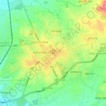
Name: פרדס חנה - כרכור topographic map, elevation, terrain.
Location: פרדס חנה - כרכור, נפת חדרה, 海法区, 以色列 (32.44461 34.94184 32.50512 35.01488)
Average elevation: 45 m
Minimum elevation: 11 m
Maximum elevation: 101 m
Other topographic maps
Click on a map to view its topography, its elevation and its terrain.