
Thank you for supporting this site ❤️
Make a donation
Make a donation
Engenberg topographic map
Click on the map to display elevation.
Thank you for supporting this site ❤️
Make a donation
Make a donation
Engenberg
Der Ortsname stammt vom Personen(kurz)namen Enge oder Ëmmo und bedeutet somit (Siedlung an) der Anhöhe des Enge/Ëmmo.
Thank you for supporting this site ❤️
Make a donation
Make a donation
About this map
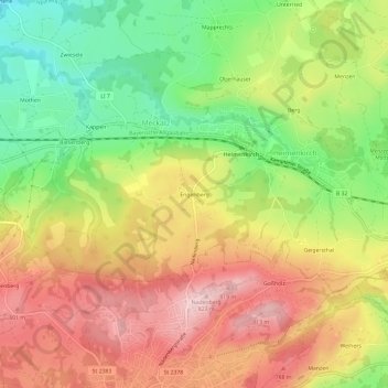
Name: Engenberg topographic map, elevation, terrain.
Average elevation: 706 m
Minimum elevation: 583 m
Maximum elevation: 821 m
Thank you for supporting this site ❤️
Make a donation
Make a donation