San Vicente topographic map
Interactive map
Click on the map to display elevation.
About this map
![San Vicente topographic map, elevation, terrain](/pub/maps/relation/8c51/sb121h/thumbnail.jpg)
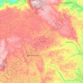
Name: San Vicente topographic map, elevation, terrain.
Location: San Vicente, Oriente, Antioquia, Colombia (6.22392 -75.40443 6.40079 -75.22777)
Average elevation: 2,160 m
Minimum elevation: 1,541 m
Maximum elevation: 2,529 m
Other topographic maps
Click on a map to view its topography, its elevation and its terrain.
![Tierra Adentro topographic map, elevation, terrain](/pub/maps/node/wks8/wjcjdwnx/icon.jpg)
Tierra Adentro
Colombia > Antioquia > Tierra Adentro
Tierra Adentro, Bello, Valle de Aburrá, Antioquia, Colombia
Average elevation: 1,939 m