
Thank you for supporting this site ❤️
Make a donation
Make a donation
Amareleja topographic map
Click on the map to display elevation.
Thank you for supporting this site ❤️
Make a donation
Make a donation
About this map
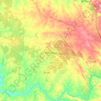
Name: Amareleja topographic map, elevation, terrain.
Location: Amareleja, Moura, Beja, Portugal (38.13805 -7.29335 38.28182 -7.15203)
Average elevation: 196 m
Minimum elevation: 100 m
Maximum elevation: 285 m
Thank you for supporting this site ❤️
Make a donation
Make a donation