
Missen topographic map
Interactive map
Click on the map to display elevation.
About this map
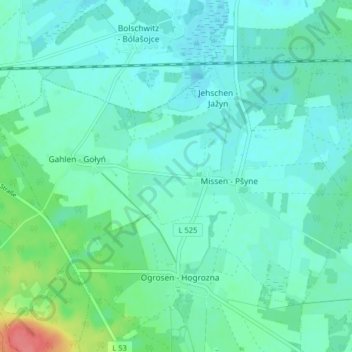
Name: Missen topographic map, elevation, terrain.
Average elevation: 74 m
Minimum elevation: 62 m
Maximum elevation: 125 m
Other topographic maps
Click on a map to view its topography, its elevation and its terrain.
Gahlen
Deutschland > Brandenburg > Oberspreewald-Lausitz > Vetschau/Spreewald
Gahlen, Missen, Vetschau/Spreewald, Oberspreewald-Lausitz, Brandenburg, Deutschland
Average elevation: 76 m
Raddusch
Deutschland > Brandenburg > Oberspreewald-Lausitz > Vetschau/Spreewald
Raddusch, Vetschau/Spreewald, Oberspreewald-Lausitz, Brandenburg, Deutschland
Average elevation: 54 m