
Thank you for supporting this site ❤️
Make a donation
Make a donation
Flône topographic map
Click on the map to display elevation.
Thank you for supporting this site ❤️
Make a donation
Make a donation
About this map
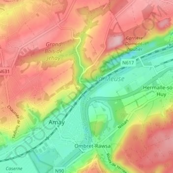
Name: Flône topographic map, elevation, terrain.
Location: Flône, Amay, Huy, Liège, Wallonie, 4540, Belgique (50.53794 5.31503 50.57794 5.35503)
Average elevation: 134 m
Minimum elevation: 44 m
Maximum elevation: 221 m
Thank you for supporting this site ❤️
Make a donation
Make a donation
Other topographic maps
Click on a map to view its topography, its elevation and its terrain.