
Thank you for supporting this site ❤️
Make a donation
Make a donation
Les Landes topographic map
Click on the map to display elevation.
Thank you for supporting this site ❤️
Make a donation
Make a donation
About this map
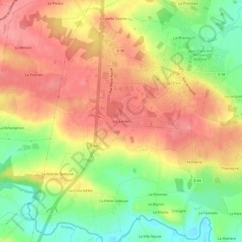
Name: Les Landes topographic map, elevation, terrain.
Average elevation: 71 m
Minimum elevation: 20 m
Maximum elevation: 109 m
Thank you for supporting this site ❤️
Make a donation
Make a donation
Other topographic maps
Click on a map to view its topography, its elevation and its terrain.
Château du Boschet
France > Bretagne > Ille-et-Vilaine > Guichen > Le Gai Lieu
Average elevation: 35 m