
Göhren-Lebbin topographic map
Interactive map
Click on the map to display elevation.
About this map
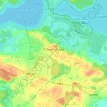
Name: Göhren-Lebbin topographic map, elevation, terrain.
Average elevation: 74 m
Minimum elevation: 59 m
Maximum elevation: 102 m
Other topographic maps
Click on a map to view its topography, its elevation and its terrain.
Poppentin
Deutschland > Mecklenburg-Vorpommern > Mecklenburgische Seenplatte > Göhren-Lebbin
Poppentin, Göhren-Lebbin, Malchow, Mecklenburgische Seenplatte, Mecklenburg-Vorpommern, Deutschland
Average elevation: 78 m