
Thank you for supporting this site ❤️
Make a donation
Make a donation
Illas topographic map
Click on the map to display elevation.
Thank you for supporting this site ❤️
Make a donation
Make a donation
About this map
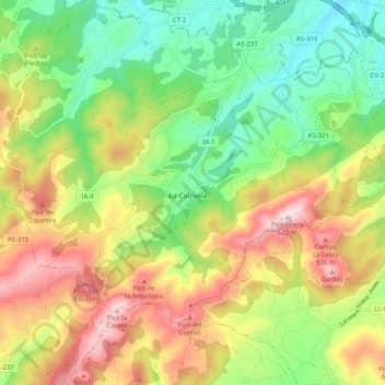
Name: Illas topographic map, elevation, terrain.
Location: Illas, Asturias, Spain (43.47119 -6.01709 43.52062 -5.91652)
Average elevation: 277 m
Minimum elevation: 35 m
Maximum elevation: 607 m
Thank you for supporting this site ❤️
Make a donation
Make a donation
Other topographic maps
Click on a map to view its topography, its elevation and its terrain.