
Bowmansdale topographic map
Interactive map
Click on the map to display elevation.
About this map
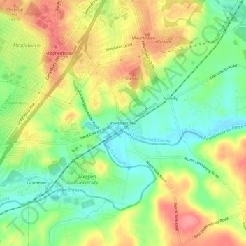
Name: Bowmansdale topographic map, elevation, terrain.
Average elevation: 153 m
Minimum elevation: 114 m
Maximum elevation: 198 m
Other topographic maps
Click on a map to view its topography, its elevation and its terrain.
Grantham
United States > Pennsylvania > Cumberland County > Upper Allen Township
Grantham, Upper Allen Township, Cumberland County, Pennsylvania, 17027, United States
Average elevation: 150 m
Shepherdstown
United States > Pennsylvania > Cumberland County > Upper Allen Township
Shepherdstown, Upper Allen Township, Cumberland County, Pennsylvania, 17055, United States
Average elevation: 153 m