
Holzhäusln topographic map
Interactive map
Click on the map to display elevation.
About this map
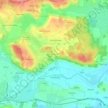
Name: Holzhäusln topographic map, elevation, terrain.
Average elevation: 531 m
Minimum elevation: 495 m
Maximum elevation: 593 m
Other topographic maps
Click on a map to view its topography, its elevation and its terrain.
Steinhöring
Deutschland > Bayern > Landkreis Ebersberg > Steinhöring
Steinhöring, Landkreis Ebersberg, Bayern, 85643, Deutschland
Average elevation: 543 m