
巴彦花镇 topographic map
Interactive map
Click on the map to display elevation.
About this map
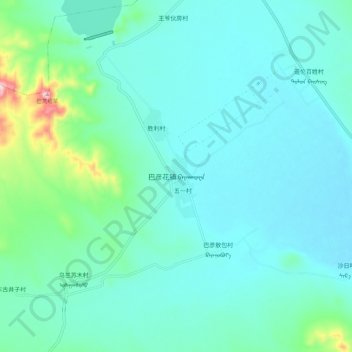
Name: 巴彦花镇 topographic map, elevation, terrain.
Location: 巴彦花镇, 阿鲁科尔沁旗, 赤峰市, 内蒙古自治区, 中国 (44.09882 119.85253 44.17882 119.93253)
Average elevation: 478 m
Minimum elevation: 433 m
Maximum elevation: 719 m