
Thank you for supporting this site ❤️
Make a donation
Make a donation
Beatrixpark topographic map
Click on the map to display elevation.
Thank you for supporting this site ❤️
Make a donation
Make a donation
About this map
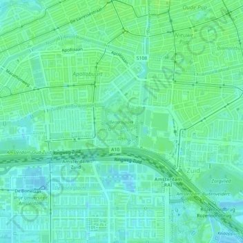
Name: Beatrixpark topographic map, elevation, terrain.
Location: Beatrixpark, Zuid, Amsterdam, Noord-Holland, Nederland (52.33966 4.87809 52.34580 4.88550)
Average elevation: 5 m
Minimum elevation: -2 m
Maximum elevation: 9 m
Thank you for supporting this site ❤️
Make a donation
Make a donation
Other topographic maps
Click on a map to view its topography, its elevation and its terrain.
Noord
Nederland > Noord-Holland > Amsterdam
Van moderne inzichten op het gebied van de volkshuisvesting was Van Hasselt niet op de hoogte. Dit leidde tot diverse conflicten met de directie van de gemeentelijke Bouw- en Woningdienst. Die wilde nu eens breken met bestaande praktijken in Amsterdam, zoals hoogbouw van 4 of 5 verdiepingen om arbeiders in…
Average elevation: 1 m
Thank you for supporting this site ❤️
Make a donation
Make a donation