
牛华镇 topographic map
Interactive map
Click on the map to display elevation.
About this map
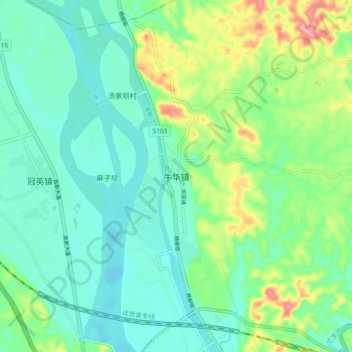
Name: 牛华镇 topographic map, elevation, terrain.
Location: 牛华镇, 五通桥区, 乐山市, 四川省, 中国 (29.42228 103.76286 29.50228 103.84286)
Average elevation: 372 m
Minimum elevation: 339 m
Maximum elevation: 460 m
Other topographic maps
Click on a map to view its topography, its elevation and its terrain.
乐山西坝镇桫椤大峡谷
乐山西坝镇桫椤大峡谷, 成渝环线高速, 桥沟, 西坝镇, 五通桥区, 乐山市, 四川省, 中国
Average elevation: 494 m