
Thank you for supporting this site ❤️
Make a donation
Make a donation
Princeton topographic map
Click on the map to display elevation.
Thank you for supporting this site ❤️
Make a donation
Make a donation
About this map
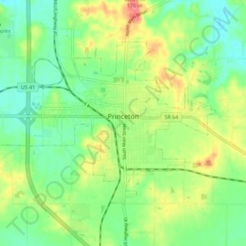
Name: Princeton topographic map, elevation, terrain.
Location: Princeton, Gibson County, Indiana, 47670, United States (38.33329 -87.61717 38.37423 -87.53832)
Average elevation: 149 m
Minimum elevation: 123 m
Maximum elevation: 190 m
Thank you for supporting this site ❤️
Make a donation
Make a donation
Other topographic maps
Click on a map to view its topography, its elevation and its terrain.