
Thank you for supporting this site ❤️
Make a donation
Make a donation
Barcis topographic map
Click on the map to display elevation.
Thank you for supporting this site ❤️
Make a donation
Make a donation
About this map
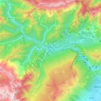
Name: Barcis topographic map, elevation, terrain.
Location: Barcis, Pordenone, Friuli – Venezia Giulia, 33080, Italy (46.12755 12.44237 46.24423 12.60335)
Average elevation: 981 m
Minimum elevation: 263 m
Maximum elevation: 2,209 m
Thank you for supporting this site ❤️
Make a donation
Make a donation
Other topographic maps
Click on a map to view its topography, its elevation and its terrain.