
Salas topographic map
Interactive map
Click on the map to display elevation.
About this map
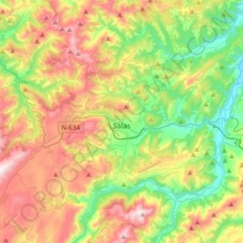
Name: Salas topographic map, elevation, terrain.
Location: Salas, Asturias, España (43.32180 -6.36259 43.49989 -6.11065)
Average elevation: 431 m
Minimum elevation: 20 m
Maximum elevation: 1,028 m
Other topographic maps
Click on a map to view its topography, its elevation and its terrain.