
Thank you for supporting this site ❤️
Make a donation
Make a donation
Cordes topographic map
Click on the map to display elevation.
Thank you for supporting this site ❤️
Make a donation
Make a donation
About this map
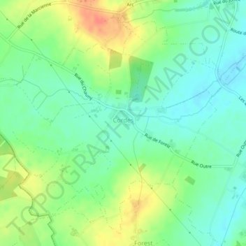
Name: Cordes topographic map, elevation, terrain.
Location: Cordes, Frasnes-lez-Anvaing, Aat, Henegouwen, Wallonië, België (50.67464 3.50834 50.69940 3.55152)
Average elevation: 42 m
Minimum elevation: 23 m
Maximum elevation: 72 m
Thank you for supporting this site ❤️
Make a donation
Make a donation
Other topographic maps
Click on a map to view its topography, its elevation and its terrain.
Thank you for supporting this site ❤️
Make a donation
Make a donation
Thank you for supporting this site ❤️
Make a donation
Make a donation