
Damascus Governorate topographic map
Interactive map
Click on the map to display elevation.
About this map
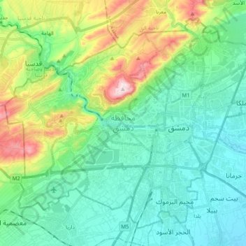
Name: Damascus Governorate topographic map, elevation, terrain.
Location: Damascus Governorate, Syria (33.45861 36.19715 33.57183 36.35593)
Average elevation: 777 m
Minimum elevation: 652 m
Maximum elevation: 1,148 m
Other topographic maps
Click on a map to view its topography, its elevation and its terrain.