
La Desertine topographic map
Interactive map
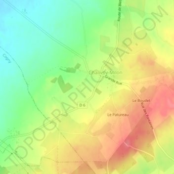
Click on the map to display elevation.
About this map
Name: La Desertine topographic map, elevation, terrain.
Average elevation: 215 m
Minimum elevation: 178 m
Maximum elevation: 251 m
Other topographic maps
Click on a map to view its topography, its elevation and its terrain.
Le Patureau
France > Centre-Val de Loire > Cher > Chalivoy-Milon
Le Patureau, Chalivoy-Milon, Saint-Amand-Montrond, Cher, Centre-Val de Loire, France métropolitaine, 18130, France
Average elevation: 219 m