
Thank you for supporting this site ❤️
Make a donation
Make a donation
Grand-Axhe topographic map
Click on the map to display elevation.
Thank you for supporting this site ❤️
Make a donation
Make a donation
About this map
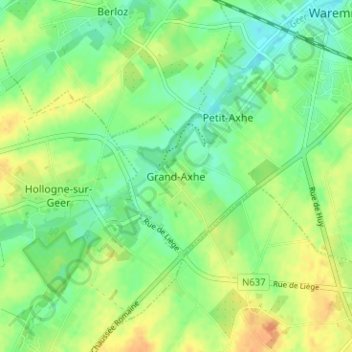
Name: Grand-Axhe topographic map, elevation, terrain.
Location: Grand-Axhe, Borgworm, Luik, Wallonië, 4300, België (50.65912 5.20536 50.69912 5.24536)
Average elevation: 127 m
Minimum elevation: 112 m
Maximum elevation: 146 m
Thank you for supporting this site ❤️
Make a donation
Make a donation