
Бородино topographic map
Interactive map
Click on the map to display elevation.
About this map
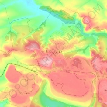
Name: Бородино topographic map, elevation, terrain.
Location: Бородино, городской округ Бородино, 克拉斯諾亞爾斯克邊疆區, 西伯利亚联邦管区, 俄罗斯 (55.86551 94.82809 55.93140 94.97103)
Average elevation: 317 m
Minimum elevation: 236 m
Maximum elevation: 393 m