
Cité Ouled Zid topographic map
Interactive map
Click on the map to display elevation.
About this map
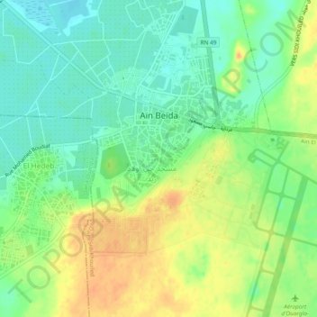
Name: Cité Ouled Zid topographic map, elevation, terrain.
Average elevation: 142 m
Minimum elevation: 125 m
Maximum elevation: 161 m
Other topographic maps
Click on a map to view its topography, its elevation and its terrain.
Aïn El Beïda
Algérie > Ouargla > Daïra Sidi Khouiled > Aïn El Beïda
Aïn El Beïda, Daïra Sidi Khouiled, Ouargla, 30019, Algérie
Average elevation: 168 m