
团堡镇 topographic map
Interactive map
Click on the map to display elevation.
About this map
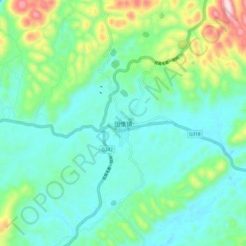
Name: 团堡镇 topographic map, elevation, terrain.
Location: 团堡镇, 利川市, 恩施土家族苗族自治州, 湖北省, 中国 (30.29571 109.09518 30.37571 109.17518)
Average elevation: 1,091 m
Minimum elevation: 965 m
Maximum elevation: 1,494 m
Other topographic maps
Click on a map to view its topography, its elevation and its terrain.