
Adelboden topographic map
Interactive map
Click on the map to display elevation.
About this map
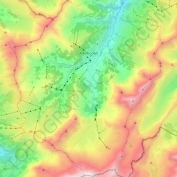
Name: Adelboden topographic map, elevation, terrain.
Average elevation: 1,962 m
Minimum elevation: 1,052 m
Maximum elevation: 3,233 m
Other topographic maps
Click on a map to view its topography, its elevation and its terrain.
Kandersteg
Suíça > Berna > Verwaltungskreis Frutigen-Niedersimmental
Kandersteg, Verwaltungskreis Frutigen-Niedersimmental, Verwaltungsregion Oberland, Berna, 3718, Suíça
Average elevation: 2,131 m