
Thank you for supporting this site ❤️
Make a donation
Make a donation
Les Trieux topographic map
Click on the map to display elevation.
Thank you for supporting this site ❤️
Make a donation
Make a donation
About this map
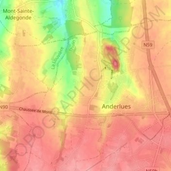
Name: Les Trieux topographic map, elevation, terrain.
Location: Les Trieux, Anderlues, Thuin, Hainaut, Wallonie, 6150, Belgique (50.39266 4.23877 50.43266 4.27877)
Average elevation: 174 m
Minimum elevation: 113 m
Maximum elevation: 204 m
Thank you for supporting this site ❤️
Make a donation
Make a donation