Geolocate

MacDonnell Ranges topographic map

Click on the map to display elevation.

MacDonnell Ranges

The highest peaks are Mount Zeil with an elevation of 1,531 metres (5,023 ft) AHD, Mount Liebig at 1,524 metres (5,000 ft) AHD, Mount Edward at 1,423 metres (4,669 ft), Mount Giles at 1,389 metres (4,557 ft) and Mount Sonder at 1,380 metres (4,530 ft) AHD; the five highest mountains in the Northern Territory. The headwaters of the Todd, Finke and Sandover rivers form in the MacDonnell Ranges. The range is crossed by the Australian Overland Telegraph Line, the Stuart Highway and the Adelaide–Darwin rail corridor at the Heavitree Gap, a water gap created by the Todd River, at the southern entrance to Alice Springs.

Wikipedia (CC-BY-SA 3.0)

About this map

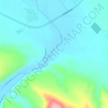
Name: MacDonnell Ranges topographic map, elevation, terrain.

Location: MacDonnell Ranges, Macdonnell Region, Northern Territory, Australia (-23.96031 132.77570 -23.96021 132.77580)

Average elevation: 594 m

Minimum elevation: 562 m

Maximum elevation: 715 m

Other topographic maps

Click on a map to view its topography, its elevation and its terrain.

Sydney

Australia > New South Wales > Sydney

Average elevation: 23 m

Tasmania

Australia > Tasmania

The most mountainous region is the Central Highlands area, which covers most of the central western parts of the state. The Midlands located in the central east, is fairly flat, and is predominantly used for agriculture, although farming activity is scattered throughout the state. Tasmania's tallest mountain…

Average elevation: 220 m

Burrum Heads

Australia > Queensland

Average elevation: 6 m

Glen Forrest

Australia > Western Australia

Average elevation: 210 m

City of Melbourne

Australia > Victoria

Melbourne's topography is characterized by a diverse landscape that transitions from flat coastal plains to rolling hills and mountainous regions. The city is situated at the northern end of Port Phillip Bay, where the terrain is predominantly flat, facilitating urban development. As one moves eastward, the…

Average elevation: 18 m

Bickerton Island

Australia

Average elevation: 11 m

Top Camp

Australia > Queensland > Toowoomba

Top Camp is 9 kilometres (6 mi) from the Toowoomba city centre via the New England Highway. It is immediately to the west of the Great Dividing Range and is at an elevation of 580 to 630 metres (1,900 to 2,070 ft).The highway passes through the eastern part of the locality from north (Kearney Springs) to south…

Average elevation: 604 m

Ashfield

Australia > New South Wales > Sydney

Average elevation: 26 m

Claremont

Australia > Tasmania > Hobart

Average elevation: 101 m

Snapper Island

Australia > New South Wales > Sydney

Average elevation: 13 m

Wyangala

Australia > New South Wales

Average elevation: 453 m

North Melbourne

Australia > Victoria > Melbourne

Average elevation: 24 m

New Italy

Australia > New South Wales

Average elevation: 34 m

Rathdowney

Australia > Queensland

Average elevation: 216 m

Howlong

Australia > New South Wales

Average elevation: 158 m

Christmas Island

Australia > Flying Fish Cove

Steep cliffs along much of the coast rise abruptly to a central plateau. Elevation ranges from sea level to 361 m (1,184 ft) at Murray Hill. The island is mainly tropical rainforest, 63% of which is national parkland. The narrow fringing reef surrounding the island poses a maritime hazard.

Average elevation: 69 m

Hobart

Australia > Tasmania > Hobart

Average elevation: 31 m

Doomadgee

Australia > Queensland

Average elevation: 52 m

Longreach

Australia > Queensland

Average elevation: 225 m

Essendon

Australia > Victoria

Average elevation: 45 m

South Brisbane

Australia > Queensland

Average elevation: 19 m

Palm Beach

Australia > Queensland > Gold Coast City

Average elevation: 6 m

Norton Summit

Australia > South Australia

Average elevation: 431 m

Mundaring

Australia > Western Australia

Average elevation: 265 m

Brooklana

Australia > New South Wales

Average elevation: 633 m

Wentworth Falls

Australia > New South Wales > Sydney

Wentworth Falls (postcode: 2782) is a town in the Blue Mountains region of New South Wales, situated approximately 100 kilometres (62 mi) west of the Sydney central business district, and about 8 kilometres (5.0 mi) east of Katoomba, Australia on the Great Western Highway, with a Wentworth Falls railway…

Average elevation: 708 m

Bell

Australia > New South Wales

Bell (postcode: 2786) is a small rural and residential village in the Blue Mountains region of New South Wales, Australia. It is the north-westernmost village in the City of Blue Mountains, located approximately 125 kilometres (78 mi) west of Sydney central business district by road or 137 kilometres (85 mi)…

Average elevation: 949 m

Kariah

Australia > Victoria

Average elevation: 142 m

Balliang

Australia > Victoria

Average elevation: 186 m

Queenscliff

Australia > New South Wales > Sydney

Average elevation: 14 m

Stanthorpe

Australia > Queensland

Owing to its elevation, Stanthorpe features a subtropical highland climate (Cfb). At an altitude of 811 metres (2,661 ft), Stanthorpe holds the record for the lowest temperature recorded in Queensland at −10.6 °C (12.9 °F) on 23 June 1961.

Average elevation: 831 m

Greenlands

Australia > New South Wales

Average elevation: 1,084 m

Wyangala Dam

Australia > New South Wales

Average elevation: 380 m

Urliup

Australia > New South Wales

Average elevation: 110 m

Langwarrin

Australia > Victoria > Melbourne

Average elevation: 71 m

Carrick

Australia > New South Wales

Average elevation: 677 m

Hyde Park

Australia > New South Wales > Sydney

We know it was timbered, as was the rest of the topography, from the early drawings of the settlement, and Director of the Botanic Gardens, Sydney J. H. Maiden has suggested that the dominant species were probably white or brittle gum (Eucalyptus micrantha), blackbutt (E.pilularis), bloodwood (Corymbia…

Average elevation: 30 m

Woodstock

Australia > Queensland

Average elevation: 150 m

Willow Grove

Australia > Victoria

Average elevation: 152 m

Armstrong Beach

Australia > Queensland

Average elevation: 10 m

Moa Island

Australia > Queensland

Average elevation: 18 m

Narellan

Australia > New South Wales > Sydney

Average elevation: 88 m

Calderwood

Australia > New South Wales

Average elevation: 100 m

South Hedland

Australia > Western Australia

Average elevation: 15 m

Fairy Hill

Australia > New South Wales

Average elevation: 46 m

Missabotti

Australia > New South Wales

Average elevation: 124 m

Logan Village

Australia > Queensland

Average elevation: 52 m

Mount Colah

Australia > New South Wales > Sydney

Mount Colah is 5 km north of Hornsby, the nearest major town centre. It is one of the most northerly suburbs of Sydney and is where the "Welcome to Sydney" sign is located. Mount Colah is the second highest suburb in Sydney by elevation. Considered one of Sydney's leafier suburbs, streets are clustered around…

Average elevation: 152 m

Warilla

Australia > New South Wales

Average elevation: 9 m

Eight Hour Reserve

Australia > Victoria > Melbourne

Average elevation: 34 m

Earlwood

Australia > New South Wales > Sydney

Average elevation: 23 m

Everton Hills

Australia > Queensland

Average elevation: 64 m

Leeton

Australia > New South Wales

Average elevation: 156 m

Medlow Bath

Australia > New South Wales > Sydney

Medlow Bath (postcode: 2780) is a village located near the highest point of the Blue Mountains, New South Wales, Australia. Located between Katoomba and Blackheath, its altitude is about 1,050 metres (3,440 ft) AHD. It is about 115 kilometres (71 mi) west-north-west of the Sydney central business district and…

Average elevation: 920 m

Violet Town

Australia > Victoria

Average elevation: 201 m

Gilgandra

Australia > New South Wales

Average elevation: 303 m

Kooralbyn

Australia > Queensland

Average elevation: 211 m

Balgowan

Australia > Queensland

Average elevation: 445 m

Lachlan

Australia > Tasmania

Average elevation: 478 m

Canning Vale

Australia > Western Australia

Average elevation: 26 m

Breeza

Australia > New South Wales

Average elevation: 318 m

Elevated Plains

Australia > Victoria

Average elevation: 445 m

Mer Island

Australia > Queensland

Average elevation: 30 m

Collingwood

Australia > Victoria > Melbourne

Collingwood's topography is mostly flat, but a prominent slope extends from Hoddle Street up to Smith Street, and also along sections of Hoddle Street.

Average elevation: 30 m

Brunswick

Australia > Victoria > Melbourne

Average elevation: 49 m

Morangup

Australia > Western Australia

Average elevation: 276 m

Budgewoi

Australia > New South Wales

Average elevation: 2 m

Lower Pappinbarra

Australia > New South Wales

Average elevation: 115 m

D'aguilar

Australia > Queensland

Average elevation: 134 m

Willina

Australia > New South Wales

Average elevation: 87 m

Merton

Australia > Victoria

Average elevation: 397 m

Como

Australia > New South Wales > Sydney

Average elevation: 29 m

Hollow Tree

Australia > Tasmania

Average elevation: 372 m

Elalamein Park

Australia > New South Wales > Sydney

Average elevation: 19 m

Sarina

Australia > Queensland

Average elevation: 129 m

Georgetown

Australia > Queensland

Average elevation: 356 m

Innes Park

Australia > Queensland > Bundaberg Region

Average elevation: 15 m

Bargara

Australia > Queensland > Bundaberg Region

Average elevation: 8 m

Glen Davis

Australia > New South Wales

Average elevation: 619 m

Greenlands

Australia > Queensland

Average elevation: 827 m

City of Subiaco

Australia > Western Australia

Average elevation: 29 m

Middlebrook

Australia > Queensland

Average elevation: 743 m

Merric Circle

Australia > New South Wales > Sydney

Average elevation: 49 m

Birrong

Australia > New South Wales > Sydney

Average elevation: 40 m

South Tamworth

Australia > New South Wales > Tamworth

Average elevation: 399 m