
Thank you for supporting this site ❤️
Make a donation
Make a donation
Shiloh topographic map
Click on the map to display elevation.
Thank you for supporting this site ❤️
Make a donation
Make a donation
About this map
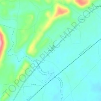
Name: Shiloh topographic map, elevation, terrain.
Location: Shiloh, Etowah County, Alabama, United States (33.95482 -86.19220 33.99482 -86.15220)
Average elevation: 195 m
Minimum elevation: 160 m
Maximum elevation: 320 m
Thank you for supporting this site ❤️
Make a donation
Make a donation