
Red Hill topographic map
Interactive map
Click on the map to display elevation.
About this map
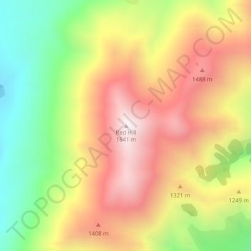
Name: Red Hill topographic map, elevation, terrain.
Location: Red Hill, Selwyn District, Canterbury, New Zealand (-43.30954 171.63154 -43.30944 171.63164)
Average elevation: 1,182 m
Minimum elevation: 696 m
Maximum elevation: 1,637 m
Other topographic maps
Click on a map to view its topography, its elevation and its terrain.
Remus
New Zealand > Canterbury > Selwyn District
Remus, Selwyn District, Canterbury, New Zealand
Average elevation: 620 m
West Melton
New Zealand > Canterbury > Selwyn District
West Melton, Selwyn District, Canterbury, 7618, New Zealand
Average elevation: 88 m
Knuckles
New Zealand > Canterbury > Selwyn District
Knuckles, Selwyn District, Canterbury, New Zealand
Average elevation: 980 m