
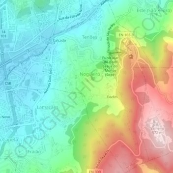
Nogueiró e Tenões topographic map
Interactive map
Click on the map to display elevation.
About this map
Name: Nogueiró e Tenões topographic map, elevation, terrain.
Location: Nogueiró e Tenões, Braga, Portugal (41.53296 -8.40214 41.56430 -8.37044)
Average elevation: 309 m
Minimum elevation: 172 m
Maximum elevation: 570 m
Other topographic maps
Click on a map to view its topography, its elevation and its terrain.
Braga (São Vicente)
Portugal > Braga > Braga > Dume
Braga (São Vicente), Dume, Braga, Portugal
Average elevation: 161 m
Senhora da Rocha
Senhora da Rocha, Nogueiró e Tenões, Braga, 4715-110, Portugal
Average elevation: 320 m