
Thank you for supporting this site ❤️
Make a donation
Make a donation
Fallston topographic map
Click on the map to display elevation.
Thank you for supporting this site ❤️
Make a donation
Make a donation
About this map
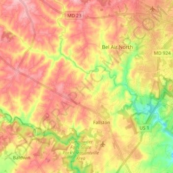
Name: Fallston topographic map, elevation, terrain.
Location: Fallston, Harford County, Maryland, 21047, United States (39.49926 -76.51273 39.57042 -76.38521)
Average elevation: 132 m
Minimum elevation: 53 m
Maximum elevation: 188 m
Thank you for supporting this site ❤️
Make a donation
Make a donation