
锡林浩特市 topographic map
Interactive map
Click on the map to display elevation.
About this map
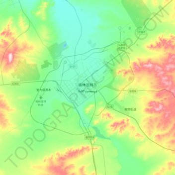
Name: 锡林浩特市 topographic map, elevation, terrain.
Location: 锡林浩特市, 锡林郭勒盟, 内蒙古自治区, 中国 (43.77121 115.91891 44.09121 116.23891)
Average elevation: 1,067 m
Minimum elevation: 957 m
Maximum elevation: 1,323 m