
東區 topographic map
Interactive map
Click on the map to display elevation.
About this map
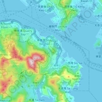
Name: 東區 topographic map, elevation, terrain.
Location: 東區, 香港島, 香港, 中国 (22.24573 114.18633 22.30028 114.26160)
Average elevation: 84 m
Minimum elevation: -6 m
Maximum elevation: 513 m
Other topographic maps
Click on a map to view its topography, its elevation and its terrain.