
West-Bordelum topographic map
Interactive map
Click on the map to display elevation.
About this map
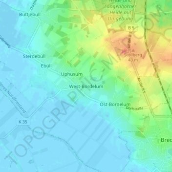
Name: West-Bordelum topographic map, elevation, terrain.
Average elevation: 12 m
Minimum elevation: -3 m
Maximum elevation: 48 m
Other topographic maps
Click on a map to view its topography, its elevation and its terrain.
Stollberg
Deutschland > Schleswig-Holstein > Nordfriesland > West-Bordelum > Stollberg
Stollberg, West-Bordelum, Bordelum, Mittleres Nordfriesland, Nordfriesland, Schleswig-Holstein, 25852, Deutschland
Average elevation: 18 m