
Thank you for supporting this site ❤️
Make a donation
Make a donation
Batallas topographic map
Click on the map to display elevation.
Thank you for supporting this site ❤️
Make a donation
Make a donation
About this map
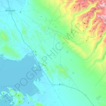
Name: Batallas topographic map, elevation, terrain.
Location: Batallas, Provincia Los Andes, La Paz, Bolivia (-16.37162 -68.57675 -16.00814 -68.20752)
Average elevation: 4,096 m
Minimum elevation: 3,809 m
Maximum elevation: 5,670 m
Thank you for supporting this site ❤️
Make a donation
Make a donation
Other topographic maps
Click on a map to view its topography, its elevation and its terrain.
Huayna Potosí
Bolivia > La Paz > Provincia Los Andes > Pucarani
Huayna Potosí is a fold mountain located in western Bolivia, near the city of El Alto and approximately 25 km (16 mi) north of La Paz, the country's administrative capital. It rises to an elevation of 6,088 m (19,974 ft) above sea level and forms part of the Cordillera Real range of the larger Andes, which…
Average elevation: 5,374 m