
Erftstadt topographic map
Interactive map
Click on the map to display elevation.
About this map
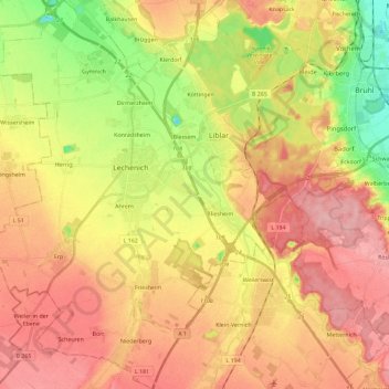
Name: Erftstadt topographic map, elevation, terrain.
Average elevation: 119 m
Minimum elevation: 52 m
Maximum elevation: 168 m
Other topographic maps
Click on a map to view its topography, its elevation and its terrain.
Bergheim
Duitsland > Noordrijn-Westfalen > Rhein-Erft-Kreis
Bergheim, Rhein-Erft-Kreis, Noordrijn-Westfalen, Duitsland
Average elevation: 84 m
Sindorf
Duitsland > Noordrijn-Westfalen > Rhein-Erft-Kreis
Sindorf, Kerpen, Rhein-Erft-Kreis, Noordrijn-Westfalen, 50170, Duitsland
Average elevation: 85 m
Paffendorf
Duitsland > Noordrijn-Westfalen > Rhein-Erft-Kreis > Bergheim
Paffendorf, Bergheim, Rhein-Erft-Kreis, Noordrijn-Westfalen, 50126, Duitsland
Average elevation: 72 m