
Bliesen topographic map
Interactive map
Click on the map to display elevation.
About this map
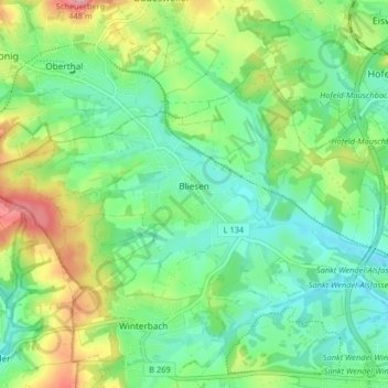
Name: Bliesen topographic map, elevation, terrain.
Location: Bliesen, Saint-Wendel, Landkreis St. Wendel, Sarre, Allemagne (49.47637 7.06774 49.51141 7.14917)
Average elevation: 327 m
Minimum elevation: 280 m
Maximum elevation: 426 m