
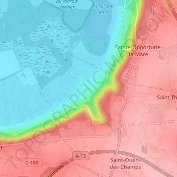
La Vallée de Saint-Thurien topographic map
Interactive map
Click on the map to display elevation.
About this map
Name: La Vallée de Saint-Thurien topographic map, elevation, terrain.
Average elevation: 66 m
Minimum elevation: -4 m
Maximum elevation: 135 m
Other topographic maps
Click on a map to view its topography, its elevation and its terrain.
Saint-Ouen-des-Champs
France > Normandie > Eure > Le Perrey
Saint-Ouen-des-Champs, Le Perrey, Bernay, Eure, Normandie, France métropolitaine, 27680, France
Average elevation: 80 m
Saint-Thurien
France > Normandie > Eure > Le Perrey
Saint-Thurien, Le Perrey, Bernay, Eure, Normandie, France métropolitaine, 27680, France
Average elevation: 111 m