
Isla Norte topographic map
Interactive map
Click on the map to display elevation.
About this map
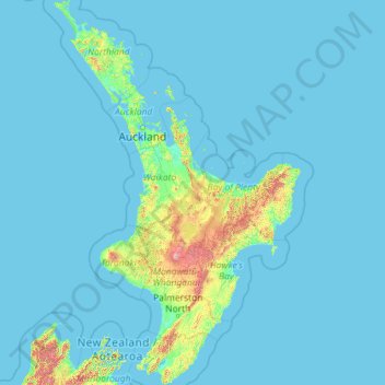
Name: Isla Norte topographic map, elevation, terrain.
Location: Isla Norte, Taupō District, Waikato, Nueva Zelanda (-41.61375 172.64293 -34.39339 178.55051)
Average elevation: 66 m
Minimum elevation: -1 m
Maximum elevation: 2,650 m